
53°31'03.5"N 9°40'08.8"E
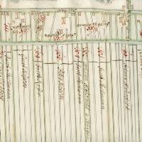
Westerladekoper Minnerweg
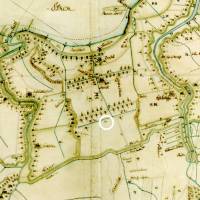
Linear structure of beds and ditches of the Hollerkolonisation
The original natural landscape of the Sietland was crossed by a network of tidal creeks and watercourses.
The situation in the marsh of the Elbe river led to the formation of different soil landscapes in the Altes Land. From the banks of the Elbe to the Hinterdeich, the main focus is on fertile clay marsh soils. They were in high contrast to the poor soils of the neighbouring Geest and the high yields contributed significantly to the development of the special Altländer culture. The further away these sediments were deposited from the Elbe, the lower is the soil quality due to increasing decalcification and susceptibility to water logging.
The typical linear structures of the sophisticated drainage systems still characterise the Altes Land until today. They have their origin in the colonisation by the Dutch colonists.
The first Dutch arrived around 1113 in the marshes of the Archbishopric of Bremen. In the first settlement areas of the first mile, acres of Marschhufen with a plot length of 2.25 km (4 ½ Altländer Morgen) can be found. With the construction of the first dykes, the plots were divided and drainage ditches were dug. The parallel ditches ran at a distance of 15 to 20 metres vertically to the dyke and ran into a Wettern parallel to the dyke, which channeled the water through a drain through the dyke into the river. Eight of such plots next to each other usually formed one Hufe.
The Hufen were broad stripes of about 150 m width and 2.25 km length, they contained about 33.5 ha.
The settlers built dykes along the Elbe, the tributaries and towards the moor and drained the dyked area. They had the knowledge about hydraulic engineering techniques that had already been used in Flanders in the 10th and 11th centuries. The local ribbon farm colonies, dating back to the 10th century had the same characteristics as the settlements of the Altes Land:
“In dyked polders rectangularly measured plots with rows of farmsteads and mostly yard adjoining standardised broad stripes, the Marschhufen, which were drained by parallel ditches and transversally Wettern”.
The Hollerkolonisation influenced the original landscape. Visible from the air, the typical linear bed and ditch structure of the planned Marschhufen can be seen. The water flowing from the Geest and the rainwater were drained into the Elbe through extensive hydraulic engineering measures by means of a system of ditches, Wettern and sluices, which still exist in many parts. The former tidal creeks of the original landscape can still be seen on aerial photographs and in the digital terrain model.
Westerladekoper Minnerweg
The Minnerwege were originally not intended for through traffic. The name has probably resulted by merging the Low German utterance “bi dem Inwege”.
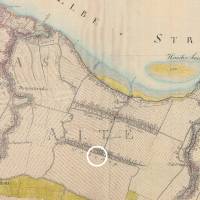
Ladekop was probably founded in approximately 1197. Today’s village streets Wester- and Osterladekop could have been the dyke with a one-sided settlement towards the south with the parallel running Wettern.
The course of settlement work in Ladekop in the 13th century is similar to that in Jork. The first step is the construction of the Ladekoper Wettern; from the excavated earth, the Ladekoper Minnerweg is created as a temporary Achterdeich. The water from the Wettern gets access to the Jorker Fleet. Today the plot is called Dwalk. The Neuenkirchen Hinterdeich already existed on the western side towards the Lühe. There was needed safeguard towards the Este to Neuland, Vogelsang and behind the Hohes Moor; for this purpose the Osterladekoper Halbfehrden was used. For the agricultural use of the entire area, the high Hinterdeich had to be built in the south towards the moor. On the moor side of the Hinterdeich, the settlers dug the deep and wide Moorwettern; they cut off the source of the creeks of the Zester, the Staubek from the Ihlteichen in the forest of Neukloster and the Mühlenbek, which was originally called Bredenbek. From the excavated moor soil the high Hinterdeich was erected and raised by an excavated ditch towards the inland with the firmer marsh soil.
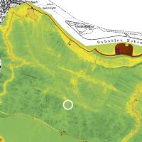
The road to Neukloster was built in 1844/1859. Today the Halbfehrden is part of the European cycling track and is often used by students on their way to school to Buxtehude. From the new motorway bridge one has a good view over the orchards to the Geestrücken on the northern banks of the Elbe and Hamburg-Blankenese.