The Time frames on the topic:
Settlement structures
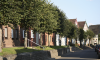
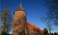
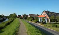
Maps and aerial photographs show the outline of the Altes Land even though no boundary lines are drawn there. The bed and ditch structures of the Hollerkolonie are still visible today. The ribbon farms and Deichhufendörfer follow this linear structure. Centres were formed around churches, bridges and ports.
Almost all the time frames of the Hollerweg have overlapping topics. However, they are always assigned to only one topic. The topic, which becomes more vivid at this point, than elsewhere.
Time frames on the topic settlement structure:
You may find also information about settlement structures at…