
53°33'02.8"N 9°39'55.2"E
Neuenschleuse
Historic development of sluices
The original natural landscape between the Schwinge, Lühe, Este and Süderelbe was crossed by tidal creeks. At high tide, Elbe water flowed over the tidal creeks into the Sietland, which lies below sea level, and drained off again at low tide. Rainwater and groundwater could also drain off via the tidal creeks.
In the course of the medieval Hollerkolonisation, the land was dyked and a complex draining system was created to regulate the water level in the polder. It is still regulated today.
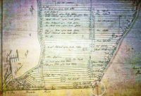
This required a large-scale measurement and planning. The natural watercourses of the tidal creeks were included in the planning and can be recognised today by the name Fleet (canal). Ditches and Wettern were dug by hand using the possibilities of the Middle Ages.
The differences in altitude within the Altes Land were challenging. The rainwater and groundwater had to be drained off the Sietland, which was partly below sea level. The differences in altitude, which in some cases were only a few decimetres, were cleverly used for draining. The water was channelled through thousands of kilometres of ditches into the canals (Fleet) and Wettern, from where it is drained through the dykes via sluices to this day.
The medieval draining of the marshland led to a gradual subsidence of the groundwater level in the Altes Land over the centuries. The time period in which the sluice gates opened automatically and water could flow out became increasingly shorter. There was no longer enough water for draining.
Old, small sluices in the Elbe dyke were removed in the early modern period (1450-1650). They were replaced by larger sluice gates that could drain the water from several Wettern. In the low-lying Sietland, longer drainage canals were built leading to the Elbe or to the lower courses of the rivers Schwinge, Lühe and Este. This improved draining. However, the previously described effect intensified and the groundwater level continued to subside.
At the end of the 19 th and in the 20 th century, even the larger locks had difficulties in draining the inland water. The construction of motorised pumping stations which could drain the water regardless of the water level began during this period.
In the middle of the 20 th century, a new technique was introduced, which is known as poldering of the orchard areas in the Altes Land. The ditches between the rows of trees were closed and replaced by drainage pipes. The collected water is pumped into the Wettern via electric pumps.
Neuenschleuse
The so-called "Neuenschleuser Wettern" carries water coming from Neuenkirchen and Ladekop through the lock of the Hinterdeich to the Elbe. In 1920, the road next to the Wettern was built from the Hinterdeich to Westerjork and onwards to Neuenschleuse Port (today called Yachthafenstraße). It was frequently used since most ships transporting fruit to Hamburg left from there.
Originally, Neuenschleuse was never an independent place, which is why there are no clear borders to Borstel and Wisch. The name was derived from the old designation "bei der Neuen Schleuse” (at the new lock). At that time, the "old lock" was the lock in Borstel at Borstel Port.
The new lock was located in the old Elbe dyke. This is where the car park is today. The main road roughly follows the old dyke line. The water from the Neuenschleuse Wettern was drained off via this sluice through the old Elbe dyke into the Neuenschleuse Port. After the storm surge disaster in 1962, the main dyke line was modified and since then the port is located inland. Now the water is drained from the port through a new ‘New Sluice’ through the Elbe dyke into the Elbe.
Before the new dyke was built, the old Wesselhöft inn stood directly on the dyke in Neuenschleuse at the port. The old dyke was planted with an avenue of walnut trees.